

|
Berita
Berita BNPP
The Border Dynamics of Sabah, Sarawak, and Brunei Darussalam: Navigating History, Sovereignty, and Cooperation
Dibuat Admin BNPP
30 Oct 2025, 16:54 WIB

By: Drs. Hamidin - BNPP RI Expert Group
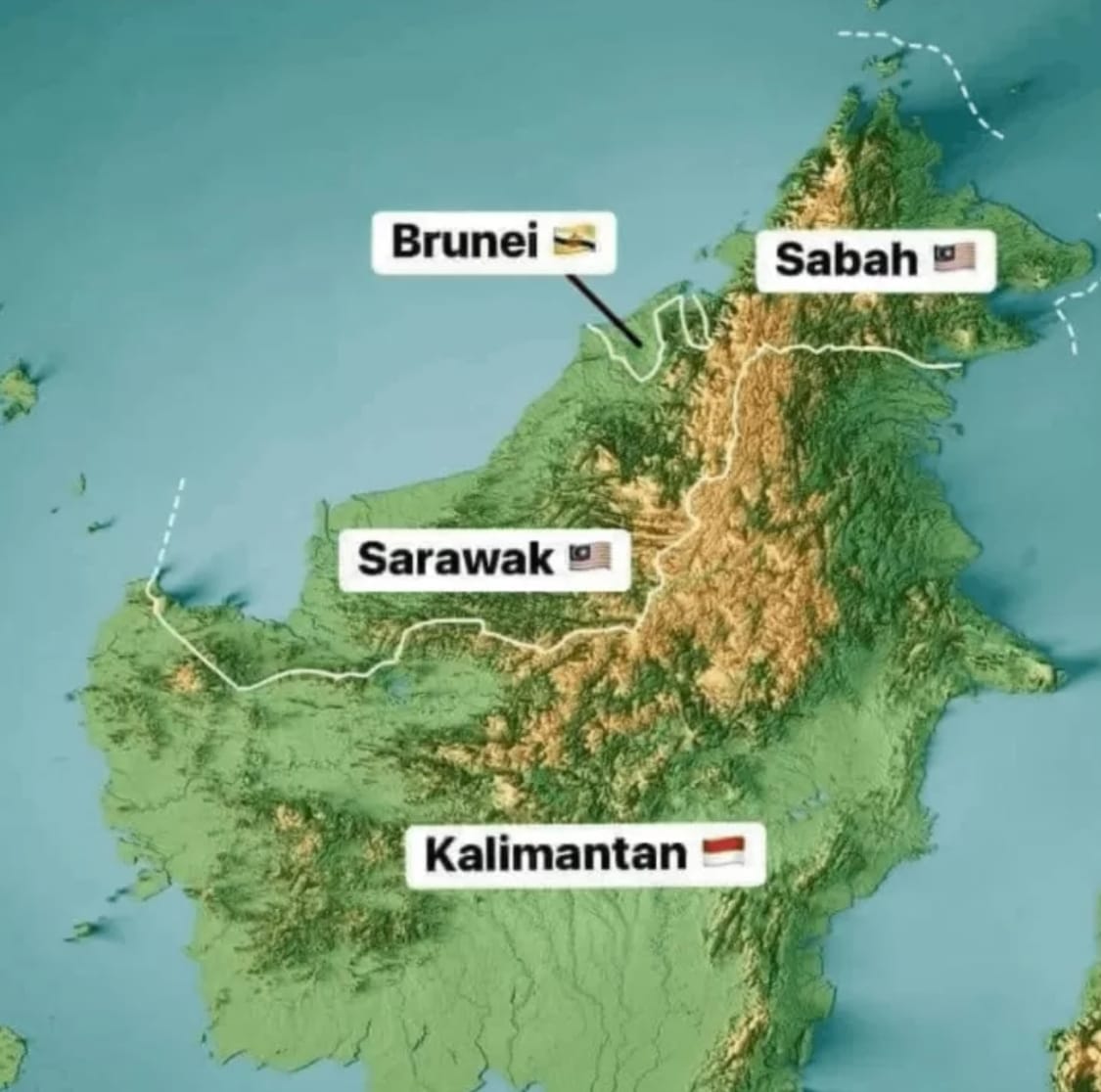
The island of Borneo stands as one of Southeast Asia’s most geopolitically significant regions—a shared space where the borders of Indonesia, Malaysia, and Brunei Darussalam intersect, and where history, sovereignty, and natural wealth are deeply intertwined. In the north, Malaysia governs the states of Sabah and Sarawak, while Brunei remains a small yet prosperous sultanate. Between these territories lies a complex web of historical legacies, socio-economic interdependence, and unfinished boundary demarcations that continue to shape the regional landscape of postcolonial Southeast Asia.
Colonial Legacies and the Roots of Dispute
The roots of contemporary border issues trace back to the 19th century, when much of northern Borneo was under the influence of the Brunei Sultanate. Over time, Brunei’s territorial reach diminished through a series of concessions and land grants to European powers. The Brooke dynasty, known as the “White Rajahs,” consolidated their rule in Sarawak, while the British North Borneo Company gained control over what would become Sabah.
These arrangements, often based on ambiguous private charters rather than formal treaties, left behind unclear territorial boundaries. When Malaysia was formed in 1963, colonial administrative lines were adopted as national borders. However, Brunei—achieving full independence in 1984—later sought to revisit some of these arrangements, particularly concerning its borders with Sarawak. The result is a lingering patchwork of historical claims, where colonial-era legacies continue to influence modern sovereignty.
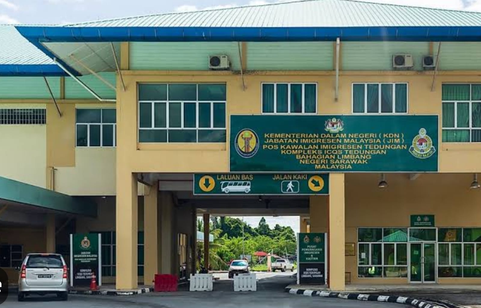
The Limbang Question and Land Demarcation
At the heart of Brunei–Malaysia land boundary issues lies the Limbang district, located between Brunei’s eastern and western territories. Malaysia views Limbang as an integral part of Sarawak, annexed by the British in 1890 following a local uprising. Brunei, however, has historically maintained its claim to the area.
The 2009 Exchange of Letters between both governments was widely interpreted by Malaysia as Brunei’s acknowledgment of its sovereignty over Limbang. Yet, Brunei never made this position explicit. As a result, the issue remains diplomatically delicate—managed through quiet dialogue rather than confrontation, in the spirit of maintaining bilateral goodwill.
Technically, the physical demarcation of the Brunei–Malaysia border remains a challenge, as the terrain cuts through dense forests and river systems. The Joint Land Boundary Technical Committee continues to address these complexities, reflecting how border-making in Borneo involves not only diplomacy but also the logistics of mapping and natural geography.
Maritime Boundaries and Energy Interests
Beyond land, the maritime frontiers surrounding Brunei, Sabah, and Sarawak hold some of Southeast Asia’s richest offshore oil and gas reserves. In the early 2000s, overlapping exploration rights in the South China Sea sparked tensions between Malaysia’s Petronas and Brunei’s Petroleum Authority. The issue was resolved through the 2009 agreement establishing Commercial Arrangement Areas, allowing for joint exploration and development.
Nevertheless, the precise maritime boundaries remain unpublished, leaving certain gray zones open to interpretation. This episode underscores that borders in Borneo are not solely about sovereignty—they are also about strategic resources, national interests, and shared prosperity. Every nautical mile in these waters carries implications for regional stability and economic growth.
Social Fabric and Cross-Border Mobility
The borderlands of Sabah, Sarawak, and Brunei are bound by more than political lines—they are linked by deep cultural and familial ties among the Dayak, Kedayan, and Bruneian Malay communities. Daily life in these regions reflects a fluid social geography where commerce, kinship, and movement transcend borders.
Many Sarawakians commute or migrate to Brunei in search of higher incomes, while Bruneian residents rely on neighboring Malaysian towns for goods and services. This interdependence, while economically beneficial, also challenges the capacity of states to manage informal trade and migration effectively.
For policymakers, the lesson is clear: sustainable border management must balance security with human development. Focusing solely on control risks neglecting the shared livelihoods that have long sustained border communities.
Security Dynamics and Regional Cooperation
Geographically, the borders of Sabah, Sarawak, and Brunei sit at a critical juncture between the Sulu and South China Seas—waters that have seen smuggling, piracy, and cross-border militancy. The 2013 Lahad Datu incident, when armed militants from the Philippines landed in Sabah, prompted Malaysia to strengthen its security apparatus. Indonesia also intensified patrols in North Kalimantan to prevent illegal crossings, while Brunei maintained vigilance through its policy of neutrality and stability.
Recognizing that no nation can tackle these challenges alone, the Trilateral Maritime Patrols (TMP)—involving Indonesia, Malaysia, and the Philippines—were launched in 2017 under ASEAN’s framework. These joint efforts enhance intelligence-sharing and maritime surveillance, demonstrating that regional peace depends on both collaboration and shared prosperity.
Toward Integrated Border Management and Cooperation
In recent years, Southeast Asia’s border narrative has gradually shifted from “lines of separation” to “zones of cooperation.” The Brunei–Indonesia–Malaysia–Philippines East ASEAN Growth Area (BIMP-EAGA) embodies this transformation, fostering connectivity, trade, and infrastructure across the region’s frontier economies.
For Brunei, the initiative diversifies its economy beyond hydrocarbons; for Malaysia, it strengthens the inclusion of Sabah and Sarawak in national development; and for Indonesia, it accelerates growth in North Kalimantan and other peripheral provinces. However, the full realization of this shared vision depends on two crucial elements: clear border demarcation and effective governance. Without these, even the most ambitious cooperation frameworks risk being undermined by uncertainty.
Conclusion
The border issues among Sabah, Sarawak, and Brunei Darussalam illustrate the enduring complexities of nation-building in postcolonial Southeast Asia. Despite historical grievances, the three nations have chosen pragmatism over provocation—managing disputes through diplomacy and focusing on mutual economic gain.
The three nations understand that peace and cooperation yield greater dividends than zero-sum territorial claims. What remains is not merely to draw clearer lines on maps, but to build inclusive border zones—with infrastructure, legal clarity, and prosperity for the people who live along them.
Ultimately, the management of these borders is not a technical exercise alone. It is part of a broader strategy to forge sovereignty with justice and security with humanity in the heart of Borneo.
(Humas BNPP RI)
Footnotes
1. Saunders, Graham. A History of Brunei. Oxford University Press, 1994.
2. Singh, Bilveer. Brunei Darussalam: Security and Defence. ISEAS, 2013.
3. “Exchange of Letters between Brunei Darussalam and Malaysia,” Government of Brunei Darussalam Gazette, 2009.
4. Leong, Ho Khai. “Malaysia-Brunei Territorial Disputes and the 2009 Agreements.” Contemporary Southeast Asia, vol. 32, no. 1, 2010.
5. Chin, James. “Cross-Border Relations in Northern Borneo.” Asian Survey, vol. 49, no. 3, 2009.
6. Banlaoi, Rommel. Maritime Terrorism in Southeast Asia: The Abu Sayyaf Threat. Routledge, 2011.
7. ASEAN Defence Ministers Meeting (ADMM) Joint Declaration, Manila, 2017.
Share
Kategori Berita
Berita BNPP
PLBN
Berita Nasional
Berita Perbatasan
Pers Rilis
Berita Utama
Berita Terbaru

BNPP RI Perkuat Kapasitas Aparatur, Dorong Penataan Ruang Kawasan Perbatasan yang Efektif dan Berdaya Saing
BNPP RI Gelar Upacara Hari Lahir Pancasila 2026, Teguhkan Peran Pancasila sebagai Pemersatu Bangsa

Menjadikan Laut sebagai Beranda Wisata ASEAN
Rayakan Idul Adha 1447 H, PLBN Aruk Perkuat Kebersamaan Masyarakat Perbatasan RI–Malaysia
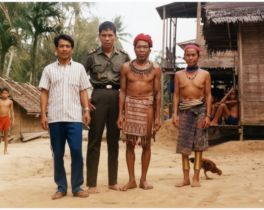
Mendalami Suku Dayak di Perbatasan
 25 May 2026, 09:23Oman, Pakistan, dan Pertaruhan Besar di Selat Hormuz, Ketika Diplomasi Senyap Menjadi Penentu Stabilitas DuniaLihat Selengkapnya
 23 May 2026, 18:38BNPP RI Ukur IPKP PPKP Entikong, Petakan Capaian dan Tantangan Pembangunan PerbatasanLihat Selengkapnya
 23 May 2026, 18:29BNPP RI Petakan Tantangan Perbatasan Nangabadau Lewat Pemutakhiran IPKPLihat Selengkapnya
 23 May 2026, 14:34Dedikasi Jaga Perbatasan, Dua Petugas Keamanan PLBN Skouw Terima Penghargaan Bea Cukai JayapuraLihat Selengkapnya
- 03 Jun 2026, 23:54BNPP RI Perkuat Kapasitas Aparatur, Dorong Penataan Ruang Kawasan Perbatasan yang Efektif dan Berdaya SaingLihat Selengkapnya01 Jun 2026, 15:45BNPP RI Gelar Upacara Hari Lahir Pancasila 2026, Teguhkan Peran Pancasila sebagai Pemersatu BangsaLihat Selengkapnya29 May 2026, 12:48Menjadikan Laut sebagai Beranda Wisata ASEANLihat Selengkapnya29 May 2026, 23:11Rayakan Idul Adha 1447 H, PLBN Aruk Perkuat Kebersamaan Masyarakat Perbatasan RI–MalaysiaLihat Selengkapnya
- 28 May 2026, 14:13Mendalami Suku Dayak di PerbatasanLihat Selengkapnya
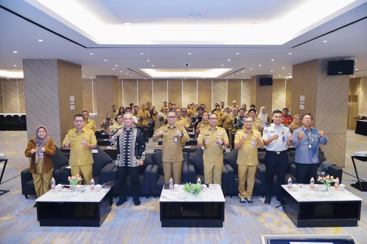 27 May 2026, 13:44BNPP RI Sepakati Percepatan Pembukaan Perlintasan Temajuk–Telok Melano, Target Operasional Agustus 2026Lihat Selengkapnya
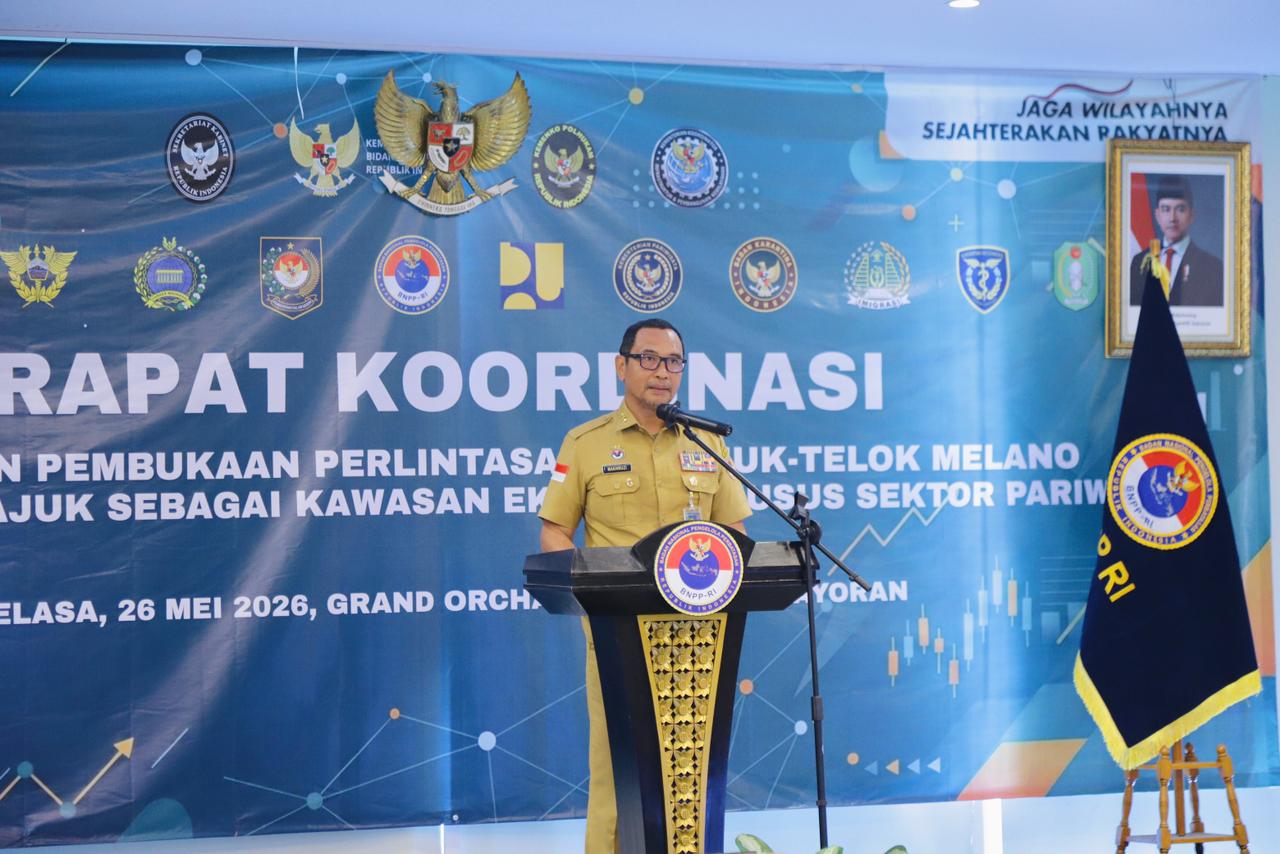 27 May 2026, 13:40BNPP RI Percepat Pembukaan Temajuk–Telok Melano, Arahkan Perbatasan Jadi KEK PariwisataLihat Selengkapnya
 26 May 2026, 10:15Belajar dari Frontex: Model Kerja Sama Penanganan Perbatasan Negara di Mediterania dan BalkanLihat Selengkapnya
  26 May 2026, 10:11Di Antara Kedaulatan dan Ketergantungan: Membaca Ulang Perbatasan Darat, Laut, dan Udara Indonesia–SingapuraLihat Selengkapnya
 26 May 2026, 09:43Menjelajahi Serumpun Borneo: Wisata dan Kuliner Memikat dari Pontianak hingga SarawakLihat Selengkapnya
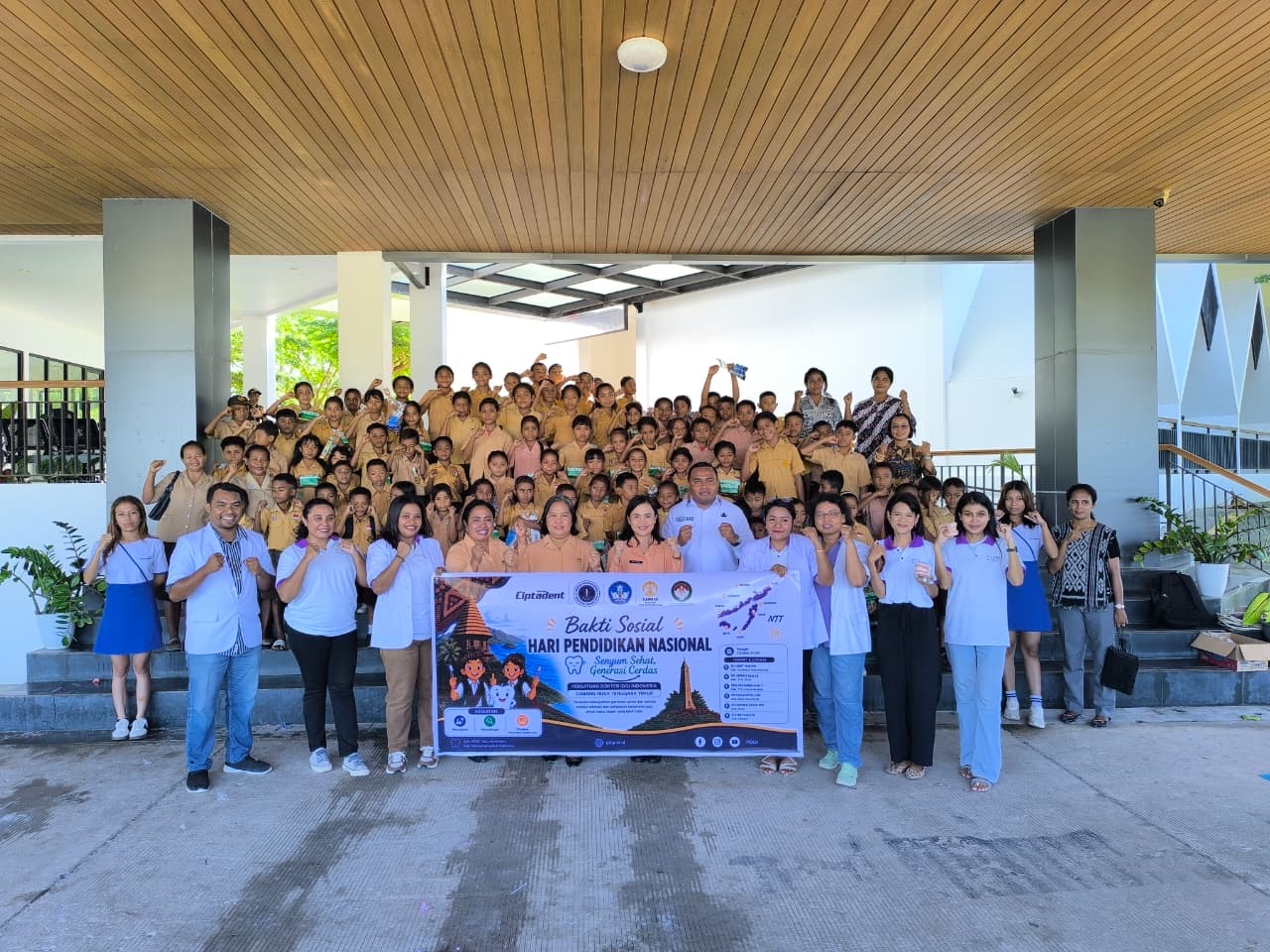 25 May 2026, 16:16DWP PLBN Motamasin Gandeng PDGI NTT, Gelar Bakti Sosial Kesehatan Gigi Anak PerbatasanLihat Selengkapnya
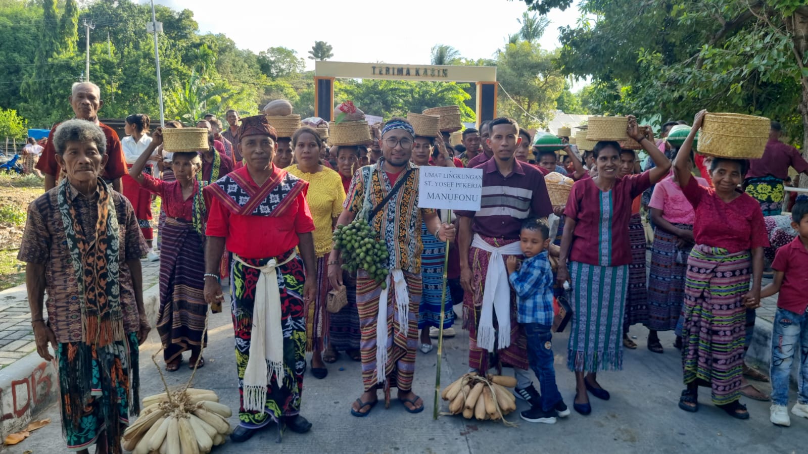 25 May 2026, 15:22Tatama Maus, Neo Uis Neno: Saat Doa Bertemu Tanah, Merayakan Hidup di Ujung Batas NegaraLihat Selengkapnya
- 25 May 2026, 09:23Oman, Pakistan, dan Pertaruhan Besar di Selat Hormuz, Ketika Diplomasi Senyap Menjadi Penentu Stabilitas DuniaLihat Selengkapnya23 May 2026, 18:38BNPP RI Ukur IPKP PPKP Entikong, Petakan Capaian dan Tantangan Pembangunan PerbatasanLihat Selengkapnya23 May 2026, 18:29BNPP RI Petakan Tantangan Perbatasan Nangabadau Lewat Pemutakhiran IPKPLihat Selengkapnya23 May 2026, 14:34Dedikasi Jaga Perbatasan, Dua Petugas Keamanan PLBN Skouw Terima Penghargaan Bea Cukai JayapuraLihat Selengkapnya
- 03 Jun 2026, 23:54BNPP RI Perkuat Kapasitas Aparatur, Dorong Penataan Ruang Kawasan Perbatasan yang Efektif dan Berdaya SaingLihat Selengkapnya01 Jun 2026, 15:45BNPP RI Gelar Upacara Hari Lahir Pancasila 2026, Teguhkan Peran Pancasila sebagai Pemersatu BangsaLihat Selengkapnya29 May 2026, 12:48Menjadikan Laut sebagai Beranda Wisata ASEANLihat Selengkapnya29 May 2026, 23:11Rayakan Idul Adha 1447 H, PLBN Aruk Perkuat Kebersamaan Masyarakat Perbatasan RI–MalaysiaLihat Selengkapnya
Badan Nasional Pengelola Perbatasan Republik Indonesia (BNPP RI)
Jl. Kebon Sirih No.31A, RT.1/RW.5, Kb. Sirih, Kec. Menteng, Kota Jakarta Pusat, Daerah Khusus Ibukota Jakarta 10340
021-31924491
info@bnpp.go.id
Quick Links
© Badan Nasional Pengelola Perbatasan - 2026